Oregon Hunt 2014
Page Three Bill's Story
First posted May 27, 2015 Last edited May 27, 2015

You've heard about half of my hunts.
The day that Ted left, and after Craig had returned from a morning hunt up their 900 trail, I went up to see what they'd spent most of a week hunting. And I discovered that the brush was not monumental everywhere. Compared to what I'd been tackling, the hike was a walk in the park. As Craig will no doubt complain, during the first fifty yards one must brush away snowbrush and young pine branches, but the ground is visible; and the rest of the way it's a piece of cake, just a matter of slaloming around bushes and stepping over the [many] occasional blowdowns. (BTW, although there were trunks supine everywhere in out burn, I ran into few blowdowns that were criss-crossed and stacked up. Most were singles, and not large in diameter, so easy to overstep.)
The problem with the hike is that it is up and up and up some more. From the "trailhead" it appears that a couple of hundred yards will get you to the top. But the top grows as you go. It just never ends! It took me an hour and a half of [what is to me, now,] constant hiking to reach "the top". But the top is just the end of the long, deerless, pull. From there it's another half hour along a ridge crest or two before one is in the real backcountry, the forest where all the big bucks supposedly live.
Worse, this was the afternoon before our first weather moved in. When I took that last step at the top, I was blasted in the face with the west wind. I dropped over the crest to glass the huge drainage that stretched before me, but I couldn't handle the wind. I popped back over onto the trail (this spot is where one actually finds the supposed trail), and took a deserved rest. Given that the afternoon was getting on and there was a half-mile or more to go, and, especially, given that that half-mile would be in the open on a crest, fighting into the teeth of that gale, I judged the better part of valor to be finding a sit a bit down on the protected east side.
The face I'd walked up (one can think of it as walking up Minnich's Ridge) had burned. But to the north, across a very shallow gully the next ridge was mostly virgin forest. The "trail" had kept to the south side of the face, for reason of fewer blowdowns. I dropped a little in elevation and walked towards the forest. The trailkeepers had had the right idea: every step brought me thicker and thicker blowdowns, plus boulders. Not a walk in the park, here.
I'd not gone far, though, before noticing some does feeding in the shallow gully boulders, some 50 yards away. I glassed them and searched for any bucks withing view, but then I couldn't let some silly women block me from making a hunt out of the day. So I walked a bit, and down to a decent temporary sit, to check out this near area a little better. That little saunter was directly at, as I noticed soon, a bedded doe only 35 yards away. But she stayed bedded, as did her nearby fawn, and simply watched me come. The three feeders, also, gave me little mind. After awhile, she stood, still looking at me; took a few steps my way, staring. You'd think that she'd had enough of a view when I'd walked, upright, right at her several minutes earlier, to have made up her mind whether or not I was a threat. So she stood, staring. I got tired of playing doe-see-doe, so I gave a bleat with my The Can, a call that purports to give an estrus bleat. She didn't like that at all (few does do, though it drives the bucks crazy; as I learned this year at the ranch), and her retreat took the other four deer along.
So I was free to continue deeper into the boulders and blowdowns. I did, and found a spot from which I could watch the edge of the forest, perhaps 50 yards away. As I sat and arranged myself, and broke off a few interfering twigs, a doe and fawn watched from 35 yds downhill; they soon simply fed away. I worked my The Can the rest of the evening, until it died, to no effect. My hope was to draw out of the forest any buck within earshot.
Then, with enough light for good visibility, I picked my way downhill through the boulders and blowdowns -have I mentioned the boulders and blowdowns, yet?- and finally crossed south and back to the relatively clear hillside I'd walked up on; and back to the car at about dark.
So, I'd now seen something of what had attracted Craig every morning. Beyond where I'd reached, it was an easy, though not short, trail all the way to the Pacific Crest Trail and the crest of the Cascades, with areas of burn but also of good, deer-hiding forest. Before, my view of the high country had been obscured by lower ridges (except for the towering spire of Mt. Jefferson); I'd had no sense of real forest anywhere existing. And the thing was, all of the serious hunters were going back there, on this trail or one of a couple of others, hiking in six, or eight, or eleven miles, usually for a few days at a time. Several we met had scouted, more than once, during the summer; they knew where the deer were and where they wanted to be. Metolius is a semi-premier Oregon unit, but it's that backcountry that produces the good stuff; the brushland is full of food and so plenty of does and young bucks.
So, now I'd seen something of...; but it's not, at least no longer, my style to climb for two hours before even beginning to think of hunting. I came, I saw, I declined.
David spent his first couple of days playing around near camp and the oft-traveled roads, skirting brush, and so I took him up 900 to broaden his horizons. I think that he hadn't fully thought through the situation, and not bought into the idea of lowlands = does & winter range / high country = mature bucks; I wanted to point him toward the type of territory that promised better chances at decent bucks. So we took a walk up the ridge. We didn't make it as far as I had before. We got to where we could see the "top", and decided that there was simply no point. So we split up- David sat below the steep edge of the south side of the ridge, overlooking a small lake, while I went north to play in the boulders and blowdowns again. Neither of us saw much. And neither of us wanted to return.
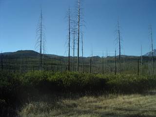
This is typical of the mid-elevation terrain near camp. And you should fill in the blank that many of the trees killed by the fire eleven years before have fallen to the ground. This was once full forest.
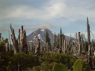
Here's Mt. Jefferson behind the area up 900 that was boulders and blowdowns. You can see where the blowdowns come from.
Addenda-
900 refers to the FS road number of the dirt track that ends at one of the trailheads. We were near the Wilderness Area boundary, so all of the roads terminated.
Since the fire, only a few of the trails have been maintained; others haven't yet been gotten to for upkeep, so they've reverted to hillside. 900 is one of those. Above the burn, there actually is a trail, in the open sand along the ridge crest; and we all found it when we reached the top of the first ridge, 1 1/2 hours into the hike. But there's nothing left of it from there down to the trailhead. Fortunately, the route is simply "go up", so the lack of a trail harms directionation not at all. 900 is a heavily used way into the backcountry, and everyone chose their own path. There was nowhere up that hill that didn't have a footprint; one couldn't go wrong. The whole face was a trail.
Partly as a result of both the amount and spread of that traffic, the hunts described in my earlier post were all low-probability. Although the top half of the next-door ridge, across the shallow, boulder gully, was forested, one couldn't really expect any wise buck to be hanging around so close to the constant stream of hikers.
David's view, and he might have a pic or two, while sitting over that little lake, was amazing. Shot opportunities or likelihoods were few and far, but he had the world spread out below him. It was from the edge of a sizeable canyon, with a clear look way up and way down, with all of the opposite ridge; and because it had all burned, one could see every bit of ground, er- brush, except what standing trunks obscured. It was a grand sit for a spot and stalk hunter, but with no possible way to make a stalk, or any kind of progress, through the brush. A place for dreamers, not for killers.
Those deer in the boulders were unseeable. Gray, rounded bodies amidst gray, rounded boulders. At 50 yards one still needed binocs to pick out an animal. There could have been hundreds of bucks bedded in there, unseen. Craig will confirm.
My The Can died on me that day. The next, David showed up and replaced it by making a birthday present of the one he'd just gotten from Cabela's (after having heard how fun it was at the Ranch).
We took a tour down to the Metolius and the confluence of the two lava flows. The land there is much more moist, with spruce and fir, and had not burned. We also found the dried remnant of an orchid (Piperia elegans, same as at the Ranch) and false Solomon’s seal. There was good feed, but we did not hunt there.
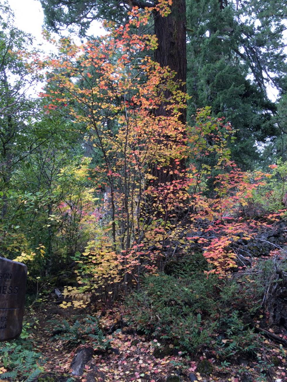
This is the trailhead to the Mt Washington Wilderness Area, but it was closed because of a burn further in. This is the path through the lava bed, a rare break in that bleak area, but then, that is why the trailhead is here:
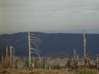
Here is another view from one of the sub-peaks of Dugout. I see nothing that a deer could eat. We found some sign, and Bill was excited when he found some scat from a large deer and followed some elk prints for a while. But we saw no deer the entire day. Pretty scenery, but we paid for hunting licenses!
David
This is the “road” to Ted’s Butt. On the right, you can see Bill snug in the bronco as I fight the rain and wind. To the left is the road I thought would go to the Butt, instead it led off to a logging area to the north. You can get some idea of the fight it took to get to the Butt. More of the misery that you know all too well.
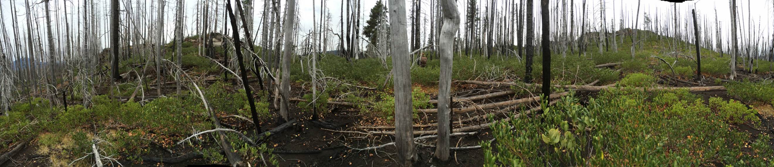
We even tried to climb the minor rockpile near camp that Ted predicted I would shoot a buck from. We wanted to call it Ted’s Butte, but decided that was a waste of the letter “e”, so it became Ted’s Butt. The peak is reached by a side road off of 900, but it does not go to the Butte, only around it. You have to fight your way through blowdowns and snowbrush (sound familiar?), only to find that you have to fight your way through chinquapin, Chrysolepis chrysophylla (http://en.wikipedia.org/wiki/Chrysolepis) and blowdowns. The chinquapin is much stiffer than snowbrush and almost impossible to penetrate. I got to the top, took this pix looking back at Bill (you can see the bronco if you look closely in the center), but it was too hard to move to be able to see out toward camp or Abbott Butte. It was raining, so Bill stayed in the Bronco as I fought my way up. The rainbow is proof it was raining.
There was a nice pocket on the lee side of the Butte, where a buck would be nicely hidden and out of the wind. I peered hard to see a resting buck, but no luck. Just like most of the trip. But not all.
Back to Wyoming Homepage